A vision for The Skjern Å River System
'With water, land must be revived' —
Set the water free and revive it as Denmark’s first and grandest Communal Nature Common.
Curious for more?
Kristine C.V. Holten-Andersen
Project Architect, Ph.D, cand.arch, Landscape Architect MDL
Location
Skjern Å, Denmark
Size
100 km / 5% of Denmark's area
Year
2024 — 2025
Client
Arkitektforeningen & Dreyers Fond
Role
Lead consultant
Partners & Collaborators
ReVærk, Arendse Marie Gulløv
As a result of the Danish Green Tripartite Agreement (“den grønne trepartsaftale”), Denmark is facing the largest landscape transformation in 200 years, with 15% of agricultural land set to be restored to untouched nature.
But how do we ensure that this transformation is integrated with the ever-increasing volumes of water pressing in from all sides, threatening settlements? And how can we use this momentum to create resilient, biodiverse, and revitalized landscapes and settlements in areas struggling to attract new residents?
In collaboration with architects ReVærk and regenerative farming consultant Arendse Marie Gulløv, we have developed a tangible vision for the Skjern Å River system – in a future with more water.
Read on below or find our full proposal (in Danish) on Issuu. It can also be downloaded as a PDF for either screen display or print.
“Setting the water free could mark a new beginning for the Skjern Å area – biologically, socially, and economically – paving the way for a wild and vast Nature Common that no one alive today has seen.”
— Kristine Holten-Andersen, Project Architect, PhD — SLA
Our vision sets out to ‘liberate’ Skjern Å, allowing the system to be revived as Denmark’s first Communal Nature Common. Instead of viewing water as a threat, we demonstrate how it can be a driving force for a blue-green transition and regional development – where nature, settlements, and agriculture coexist in new ways.
“Whether we want it or not, water will be the most powerful force of physical change for our society over the next 100 years. This is especially true for the Skjern River and its catchment area, where we can expect many more and increasingly severe floods. By working with the water rather than against it, we can restore the ecological disaster that Skjern River has endured for centuries and create a wild and expansive Nature Common, where people and a rich diversity of other species can coexist,” says Kristine Holten-Andersen, SLA –Project Architect, PhD.
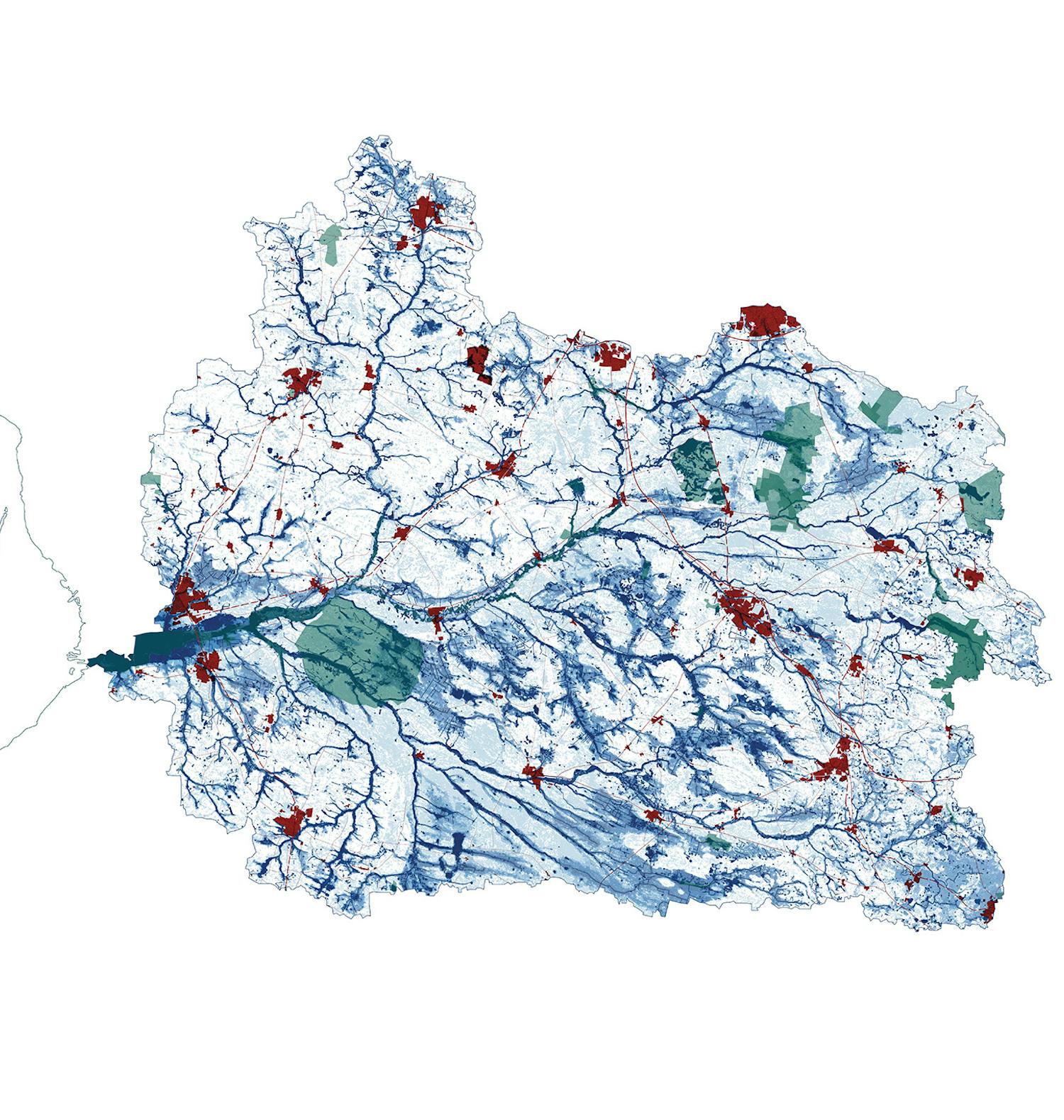
The Skjern River system is Denmark’s largest catchment area, covering 5% of the country’s total land area and spanning eight municipalities: Silkeborg, Vejle, Hedensted, Ikast-Brande, Herning, Ringkøbing-Skjern, Billund, and Varde.


A data-driven tool for municipalities at high risk
As part of the project, the team has developed the ‘Blue Potential Map’ – a GIS / geodata-based tool that helps identify areas where water’s transformative power can be strategically linked to agricultural transitions, afforestation, and new settlement opportunities. In other words, it provides a way to screen an area for synergy effects.
“There is great untapped potential in using water as a driver when municipalities reconfigure their land use – particularly in connection with the Green Tripartite Agreement. Our Blue Potential Map is a strategic, data-driven tool that municipalities can already now use to screen and initiate efforts that not only create more space for new nature but also integrate CO2 reduction and nutrient runoff mitigation with other municipal initiatives such as climate adaptation, housing, and business development,” says Kristine Engemann Jensen, biologist at SLA.
As part of the project, our team also presents concrete proposals for restoring the natural ecosystems of the Skjern River system to improve both biodiversity and water quality.

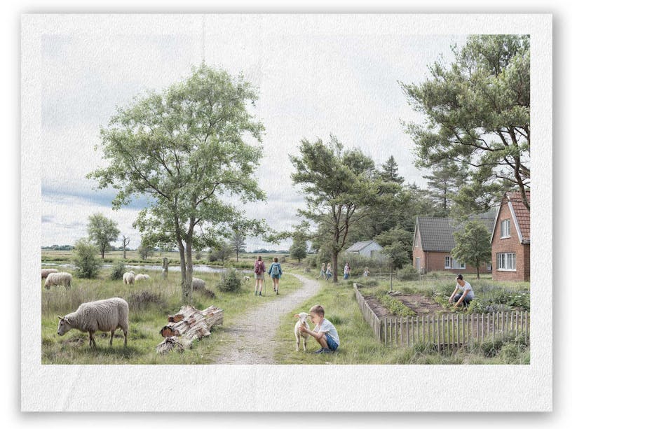
New social communities and regenerative practices
The team also presents concrete proposals for how local residents can transform existing farms and villages into attractive and resilient living environments with a focus on social communities, shared ownership, quality of life, and close proximity to nature.
Finally, the project explores new opportunities for living off the land through regenerative farming practices, modern shepherding, and nature tourism.
Our vision and development for the Skjern Å river system is part of Akademisk Arkitektforening’s and Dreyers Fonds’ open call Vandets Veje (“Ways of Water”).